The findings of the research conducted by CIGIDEN researchers in the Valparaíso Region show that 38% of the population of Viña del Mar would not be able to reach safe zones in the event of a tsunami caused by a major earthquake.
On average, earthquakes of a magnitude equal to or greater than Mw 8 are estimated to occur every 10 years somewhere in Chile. During the last 500 years, the Valparaíso Region has been particularly affected by at least six earthquakes with a magnitude of about 8, generating moderate tsunamis. According to scientific evidence, this implies an average frequency of at least one event of this magnitude every 80 years.
One of the tsunamis posing a risk in the area was the 1730 Valparaiso earthquake, with an estimated magnitude of 9.1 and 9.3. “Thanks to the work developed over the years by national and international researchers, information from historic records, dating of sediment deposits from past tsunamis and mathematical simulation of floods, we are currently able to gain a better understanding of the actual dimension of the major earthquake which struck in the early hours of July 8th, 1730”, explains Rodrigo Cienfuegos, director of the FONDAP, CIGIDEN scientific center and professor of the UC School of Engineering.
The study of this specific event made possible for CIGIDEN to conduct research and simulations for a mega-earthquake of this nature, the findings of which were captured in the policy paper “Vertical evacuation as a tsunami hazard mitigation measure in Chile”, released this Monday at a citizen science panel discussion held at Universidad Técnica Federico Santa María.
Tsunami flooding
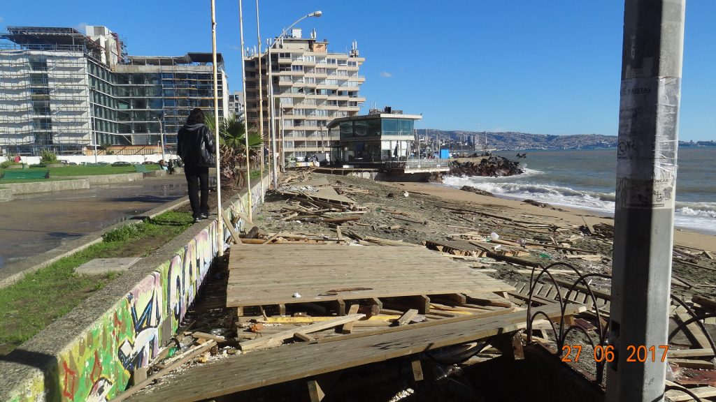 According to the authors -CIGIDEN researchers Jorge León, Natalia Zamora, Sebastián Castro, Rosita Jünemann, Alejandra Gubler and Rodrigo Cienfuegos- a tsunami like that of 1730 might impact the Valparaíso Region with expected flood depths over 6 meters near the Viña del Mar Casino and Concón. It could penetrate up to 5.5 kilometers in the wetland of the Aconcagua river, 4 kilometers in the bed of the Marga-Marga estuary in Viña del Mar; whereas, according to this model, the flood could reach up to 1.5 kilometers in Reñaca. In Valparaiso, the modelled depths tend to be somewhat shallower and the flood waters could cover up to 1 kilometer in Valparaíso.
The document states that in a scenario similar to that of 1730, about 38% of the population of Viña del Mar would not be able to reach the safe zone. Jorge León -USM professor and CIGIDEN researcher- admits that the city has areas that are suitable for evacuation, such as Peru Avenue and la Feria. “This means that people would probably be hit by a tsunami, since they are not expeditious, they are full of obstacles and, they are also located in a geographic depression,” he explains. Resident population is of about 35,000 people, about 10% of the district of Viña del Mar (2017 Census), with a having significant variation of floating population, since it concentrates the area’s tourist infrastructure.
In light of this, Rodrigo Cienfuegos believes that including vertical evacuation regulations and protocols is a pressing issue. There is international experience of public buildings that have been especially designed or adapted for this purpose, or of the creation of incentives and conditions so that condominiums or owners’ associations can safely implement vertical evacuation protocols. Countries like Japan, the United States and Indonesia have developed three types of vertical evacuation: buildings made for this purpose (towers, buildings or elevated platforms above the expected flood level), use of existing buildings modified or adapted for better evacuation and artificial hills or ridges.
Citizen Panel Discussion
 A panel discussion to debate on the policy paper was held, with the presence of Bernardita Paul, national responsible for Disaster Risk Reduction and Reconstruction of MINVU; Jeannette González, vice president of the Residents Communal Union of Viña del Mar; Jorge Brito, congressman for the Valparaíso Region and member of the political party Democratic Revolution; Cristóbal Mena, national deputy director of ONEMI and Luis Álvarez, Director of the Institute of Geography of the Universidad Católica de Valparaíso. CIGIDEN and USM researcher Mr. Patricio Catalán moderated the panel.
In his speech, Cristóbal Mena said that we all are responsible for risk management, and he described CIGIDEN’s policy papers on vertical evacuation as a navigation chart to build a strong public policy. In turn, Bernardita Paul pointed out that “these working groups (panel discussion) are extraordinary, because there are representatives from the government, scientists, researchers and citizens; which can make the dream of vertical evacuation possible.
“You have a great task ahead: teaching people that instead of escaping buildings, they must reach safe floors and open them in order for others to be saved too,” added the community representative Jeannette González. Congressman Jorge Brito said that “we need memory of disasters to lead to action on risk management, but also to be a citizen tool to demand good quality and timely reconstruction”.
Finally, Luis Álvarez, director of the Institute of Geography of the Pontificia Universidad Católica of Valparaíso, commented that the knowledge of our territory has been lost because of the way we live. “We stop learning about and appreciating our spaces. We tend to climb the stairs up some hill without stopping to think that this staircase could be the one saving our lives during a tsunami,” he warned.